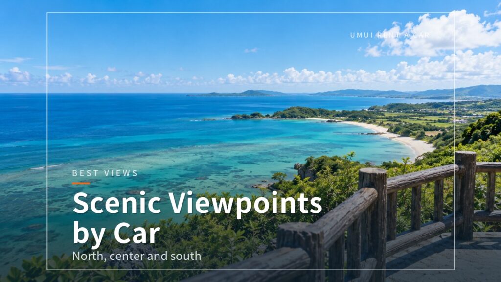
Looking for scenic spots you can reach by car on Okinawa’s main island, but not sure where to start? There are sea cliffs jutting into the ocean, a bridge that runs straight down toward the sea, and long bridges that take you out to small islands. Each part of the main island has lookouts you can drive right up to.
This article covers viewpoints and scenic spots in the north, center and south, along with parking, road conditions and the best time of day (only where an official source states one). For places we already cover in detail, the numbers match those articles and we link to them. Use it as a map when deciding what order to visit.
Before You Start a Scenic Drive
Quick Guide by Area
The scenic spots differ a lot in distance from Naha Airport. From closest to farthest: the south (Senaga Island, Niraikanai Bridge, Chinen Misaki Park, Kyan Misaki), the center to Onna Village (Zanpa Misaki, Manzamo), the islands off Uruma City (Kaichu Road, Kafu Banta), and the north (Kouri Island, Mt. Yaedake, Cape Hedo). All travel times in this article are estimates assuming no traffic.
It is easiest to plan by trip length: the south for a half day, the central seaside for a full day, and the north if you are staying overnight.
What to Watch for at Viewpoints
On cliffs and bridges it is easy to be distracted by the view, both when driving and when walking. First, do not stop on a bridge or by the roadside to take photos; pull into a parking lot first and then get out. Second, it can be windy on top of a cliff. Stay inside the fences, and keep hats and small items from blowing away.
Roads to hilly areas and headlands can have a series of curves or spots where passing oncoming cars takes care. It is hard to see the road and your footing after dark, so for distant spots, leave early and arrive while it is still light.
About the Best Time of Day
In this article we only give a “best time of day” where an official website states one. For example, the official Manzamo site says visits are possible until sunset, and Kafu Banta can only be used during the facility’s business hours. For the other spots we could not find any stated time, so we do not give one. The view changes with the weather, the tide and the crowds, so stay flexible and watch the sky on the day.
North: Kouri Island and Mt. Yaedake
Kouri Bridge and the Minamizume Viewpoint
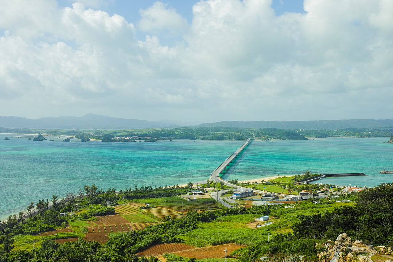
Kouri Bridge connects Yagaji Island and Kouri Island. It is about 2 km long and free to cross. Shallow sea spreads out on both sides, and its emerald green color shows through. Stopping and parking on the bridge is prohibited, so if you want to take in the view and take photos, leave your car in the free parking lot at the Minamizume Viewpoint on the Yagaji Island side and look at the bridge from the beach.
Drivers are easily distracted by the scenery. Cross at a modest speed and keep extra distance from the car ahead. For how to tour the island and a model 2-day, 1-night itinerary, see our article Northern Okinawa 2-Day Drive.
| Location | 沖縄県名護市(屋我地島)〜今帰仁村(古宇利島) |
|---|---|
| Toll | Free |
| Parking | Free parking at the Minamizume Viewpoint on the Yagaji Island side (can be full when busy) |
| Access | About 30-40 min by car from Churaumi Aquarium |
Kouri Ocean Tower
This observation facility on a hill on Kouri Island lets you see Kouri Bridge and the surrounding sea from the top of the tower. An automated cart takes you up from the entrance to the tower, so it is easy to get around with small children or older travelers. The appeal is a view of the whole bridge, which you cannot get from on the bridge itself.
| Address | 沖縄県国頭郡今帰仁村古宇利538 |
|---|---|
| Hours | 10:00-18:00 (last entry 17:30) |
| Closed | Open year-round (may close in severe weather) |
| Admission | Adults (16 and over) 1,000 yen, children (6-15) 500 yen, under 6 free |
| Parking | Yes (about 200 spaces) |
| Access | About 5 min by car from Kouri Bridge |
Yaedake Sakura-no-Mori Park
On the mid-slope of Mt. Yaedake (453 m), on the border of Motobu Town and Nago City, lies Sakura-no-Mori Park, well known for its cherry blossoms. The blossoms usually peak from mid-January to early February, and the 2026 Motobu Yaedake Cherry Blossom Festival ran from January 17 to February 1. Night illumination runs from 17:00 to 21:00 and covers only some of the trees. It is an easy addition to a winter drive in the north.
The parking lot holds about 500 cars and is free. It gets crowded during the blossom season, so allow plenty of time. You drive up a mountain road to the mid-slope, so take the curves slowly and watch for oncoming cars. For up-to-date information on blooming and traffic restrictions, it is safest to check with the Motobu Town Tourism Association (0980-47-3641).
| Location | 沖縄県本部町・名護市の境(八重岳の中腹) |
|---|---|
| Best season | Usually mid-January to early February (festival dates vary by year) |
| Parking | Yes (about 500 spaces, free) |
| Inquiries | Motobu Town Tourism Association 0980-47-3641 |
| Access | About 2 hours by car from Naha Airport; about 40 min from Kyoda IC via Route 58, Route 449 and Prefectural Route 84 |
The Far North: Cape Hedo and Kayauchi Banta
Cape Hedo
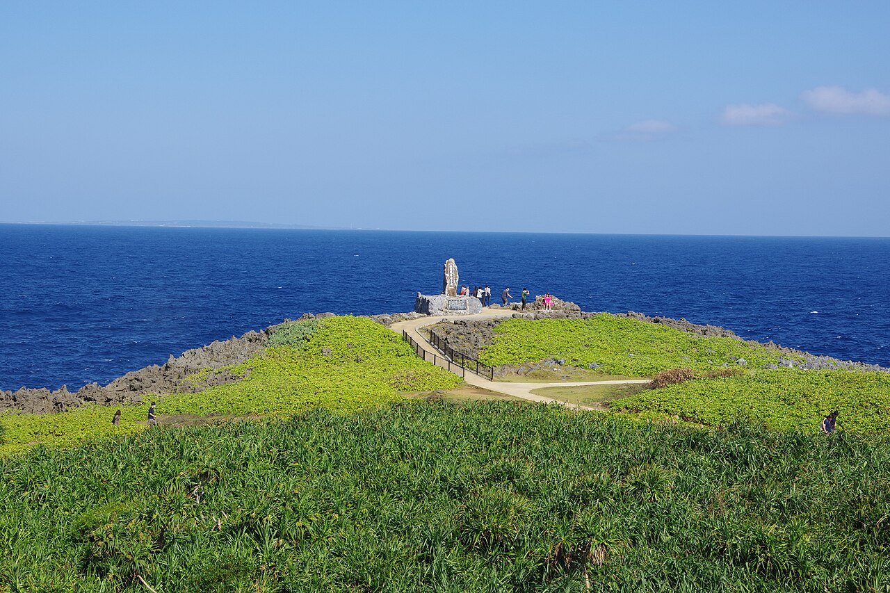
Cape Hedo is the northernmost point of the main island. A monument to the return to Japan stands at the tip, and on a clear day you can reportedly see Yoron Island and Okinoerabu Island in Kagoshima Prefecture, and Iheya and Izena Islands to the west. Limestone rocks are scattered around, and you can walk along the paths while looking at the sea. Some places have rough footing, so wear comfortable walking shoes.
| Address | 沖縄県国頭郡国頭村辺戸 |
|---|---|
| Visiting | Open access (outdoors, so watch the weather) |
| Parking | Yes |
| Access | About 30-40 min by car from Michi-no-Eki Yuiyui Kunigami |
Kayauchi Banta
A cliff-top lookout about 5 minutes by car from Cape Hedo. You look down on the Kunigami coastline and the blue sea beyond. It is a short walk from the parking lot to the lookout, but the parking lot does not hold many cars. Watch your footing near the cliff edge, and hold the hands of small children.
The far north is a long way from Naha, and the round trip alone means many hours of driving. For a course that combines Asmui (Daisekirinzan) and roadside stations, see our Yanbaru day-trip drive article.
| Address | 沖縄県国頭郡国頭村宜名真 |
|---|---|
| Visiting | Open access |
| Parking | Yes (limited spaces) |
| Access | About 5 min by car from Cape Hedo |
Central: From Kaichu Road to the Cliffs of Onna
Kafu Banta (Miyagi Island)
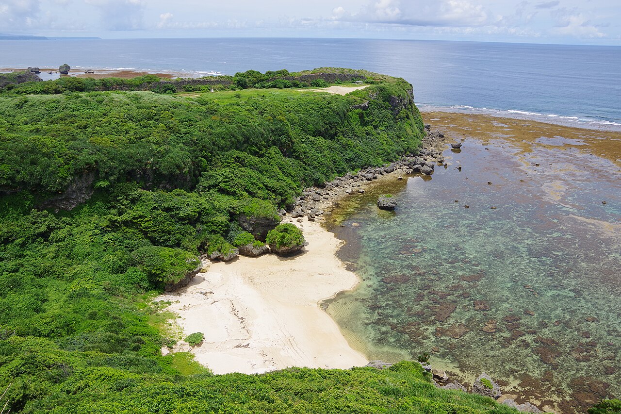
A cliff on Miyagi Island in Uruma City with a view over the Pacific. “Banta” is the Okinawan word for cliff. It is on the grounds of the Nuchimasu salt factory, and it cannot be used outside business hours, so visit early in the afternoon to avoid a last-minute rush. A walk takes about 15 minutes, and since the footing is not always good, walking shoes are recommended.
The route is across Kaichu Road to Henza Island, then over a bridge to Miyagi Island. For the whole island-hopping course, see our Kaichu Road and island-hopping drive article.
| Address | 沖縄県うるま市与那城宮城2768(ぬちまーす観光製塩ファクトリー内) |
|---|---|
| Hours | 9:00-17:30 (not available outside business hours) |
| Time needed | About 15 min to walk around the grounds |
| Parking | Not stated on the official site; follow on-site guidance |
| Access | Just across the bridge from Henza Island. About 1 hr 30 min by car from Naha Airport (estimate) |
Kaichu Road
This free road, about 4.7 km long, links the Katsuren Peninsula and Henza Island. Just driving it is a scenic experience. There are parking areas along the way where you can stop and take in the view.
With sea on both sides and almost nothing to block the wind, tall vehicles such as wagons and minivans can be pushed sideways by crosswinds. On windy days, do not force it and change your destination. Always pull into a parking area before taking photos.
| Address | 沖縄県うるま市与那城屋平(与勝半島〜平安座島) |
|---|---|
| Toll | Free |
| Parking | Parking areas along the way (including the Umi-no-Eki Ayahashikan lot) |
| Access | About 1 hr 30 min by car from Naha Airport via expressway (estimate) |
Zanpa Misaki
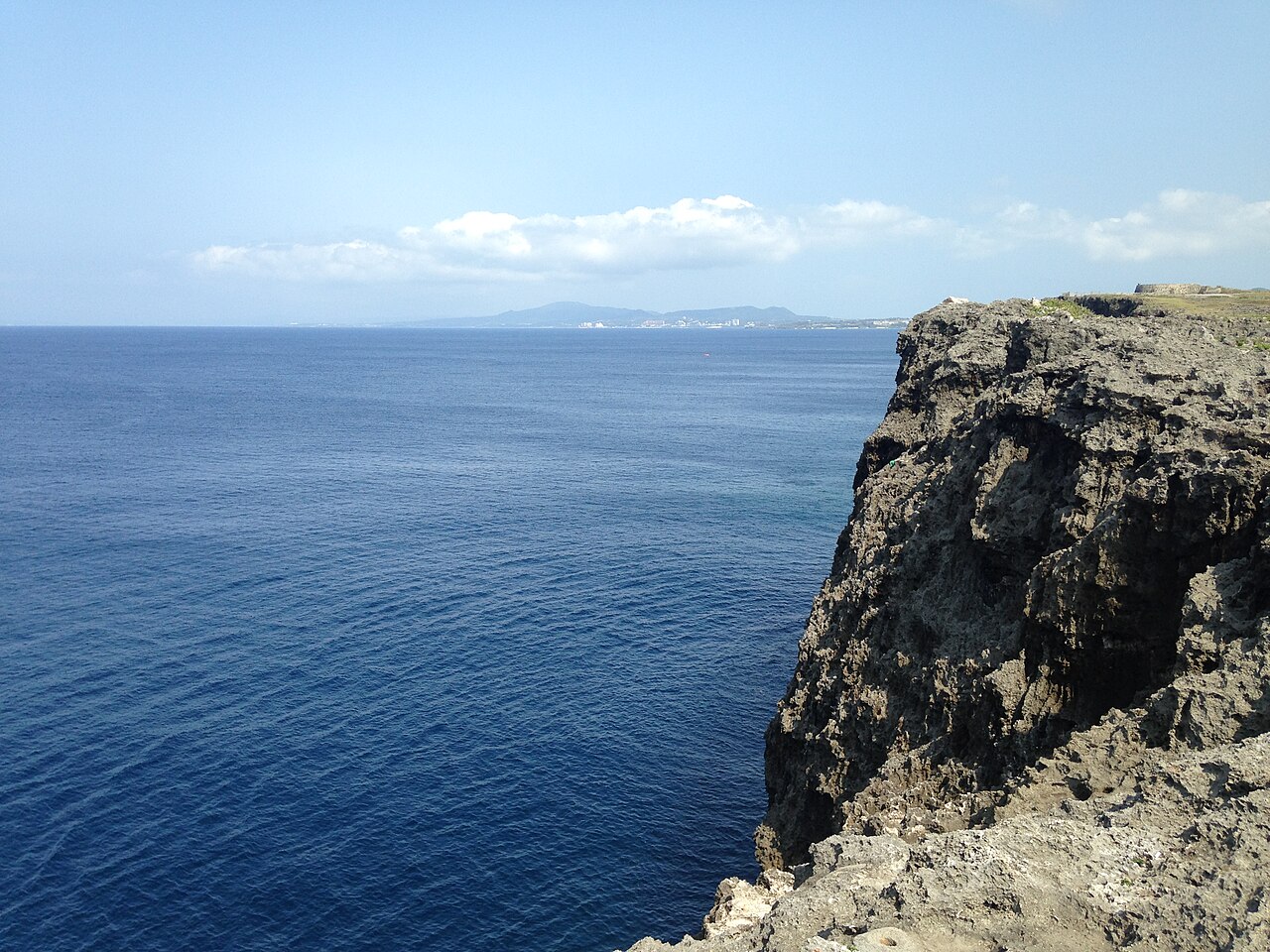
A scenic headland at the northwest tip of Yomitan Village, lined with Ryukyu limestone cliffs. The park is free to walk around, with no admission fee. On windy days or when the waves are high, do not go too close to the cliff edge. The Zanpa Misaki Lighthouse in the park is a “climbable lighthouse” where you can go up inside and look at the view. Visiting hours are 9:30-12:00 in the morning (year-round) plus an afternoon session. The afternoon hours change with the season and day of the week, so please check the Yomitan Village official website.
| Address | 沖縄県中頭郡読谷村宇座 |
|---|---|
| Visiting | Free to walk around (no admission fee) |
| Parking | Free parking available |
| Inquiries | Yomitan Village Tourism Association 098-958-6494 |
| Access | About 1 hour or more from central Naha via Route 58 (varies with traffic) |
Manzamo
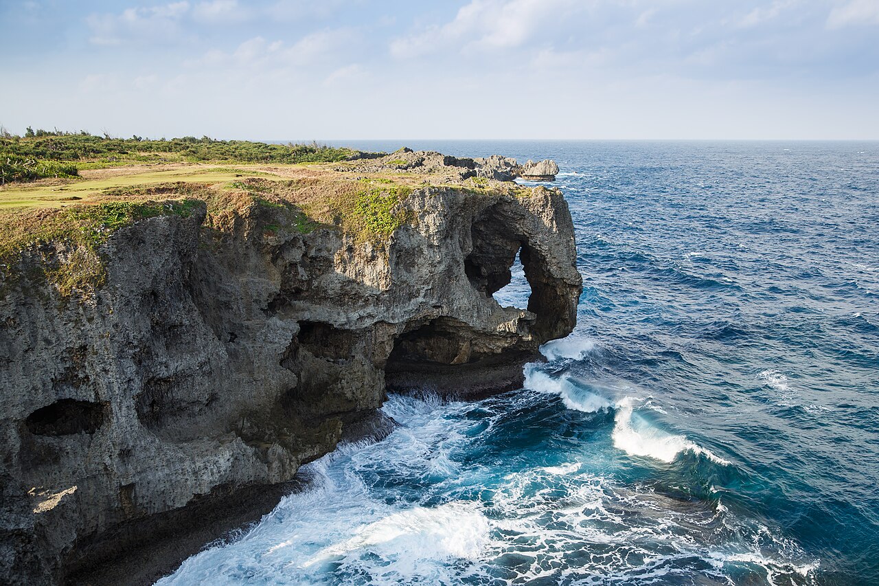
Manzamo in Onna Village is a scenic spot where a Ryukyu limestone cliff juts out into the sea, and the tip of the cliff is shaped like an elephant’s trunk. The top is a grassy plateau, and the walking path takes about 20-30 minutes to circle. The official website states that “visits to Manzamo are until sunset,” so if you want to see the sunset, arrive 30 to 60 minutes before sunset.
Parking is free, with room for more than 300 cars across the first and second lots. It can still get crowded around sunset and on holiday weekends, so arriving early is safest. For a sunset timetable and tips for the drive back on Route 58, see our Manzamo sunset drive article.
| Address | 沖縄県国頭郡恩納村字恩納2767 |
|---|---|
| Hours | 8:00-20:00 (March-October), 8:00-19:00 (November-February). Visits until sunset |
| Closed | None (may close in severe weather such as typhoons) |
| Admission | 100 yen (same for adults and children; free under elementary school age) |
| Parking | Free (Lot 1: 97 cars and 13 buses; Lot 2: 218 cars) |
| Access | About 1 hr to 1 hr 15 min by car from Naha Airport |
South: A Bridge Down to the Sea and Cape Views
Niraikanai Bridge
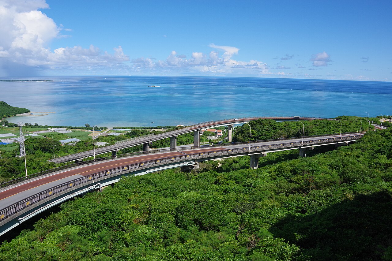
Niraikanai Bridge in Chinen, Nanjo City, is a gently curving bridge made up of the “Nirai Bridge” on the mountain side and the “Kanai Bridge” on the sea side. If you drive from Prefectural Route 86 down toward Route 331, you keep the sea in front of you the whole way down. From the bridge you can reportedly see Chinen Misaki and, far away, Kudaka Island.
The official tourism site says there is no parking, and you cannot stop on the bridge to take photos. It is easy to pick up speed while looking at the view, so keep your distance and stay at the legal speed limit. The bridge may be closed during typhoons or bad weather. For route details, see our southern half-day drive article.
| Address | 沖縄県南城市知念吉富 |
|---|---|
| Access to the bridge | Open (closed during typhoons or bad weather) |
| Parking | “None” on the official tourism site (no stopping or parking on the bridge) |
| Access | On the way down from Prefectural Route 86 (Tsukishiro side) to Route 331 / about 40 min to 1 hr by car from Naha Airport |
Chinen Misaki Park
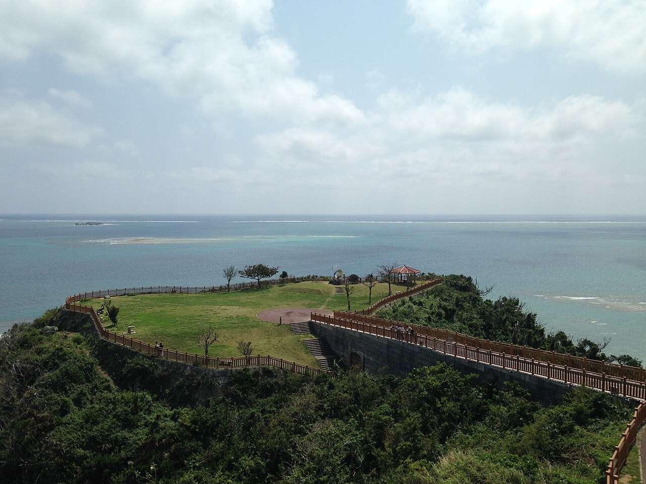
A park on a headland surrounded by sea on three sides, just beyond the Nanjo City Regional Products Center. The official tourism site calls it a “scenic park that makes you cheer out loud.” It has a red-tiled pavilion and a walking path, with almost nothing blocking the view of the Pacific and Kudaka Island floating offshore.
| Address | 沖縄県南城市知念字久手堅 |
|---|---|
| Hours | Not stated on the official tourism site (no closing day) |
| Parking | Yes (also listed as parking for Sefa Utaki; follow on-site guidance when busy) |
| Access | Just behind the Nanjo City Regional Products Center / about 1 hr by car from Naha Airport |
Kyan Misaki
This cape in Itoman City is at the southernmost end of the main island. It is said to divide the East China Sea from the Pacific. A lighthouse and observation deck stand on the cliff, and the “Tower of Peace,” built in 1969, stands at the tip. It is open access. The parking lot is small, with 15 spaces, so during holidays and busy seasons you may not find a spot. The nationally designated historic site Gushikawa Castle Ruins is nearby.
According to tourist information sites, it is about 16 km and 40 minutes by car from Naha Airport. We could not find opening hours, so it is safest to check with the Itoman City Commerce and Tourism Division (098-840-8135) before you go.
| Address | 沖縄県糸満市字喜屋武 |
|---|---|
| Visiting | Open access |
| Parking | Yes (15 spaces, free, including 2 for people with disabilities) |
| Inquiries | Itoman City Commerce and Tourism Division 098-840-8135 |
| Access | About 16 km, about 40 min by car from Naha Airport |
Senaga Island
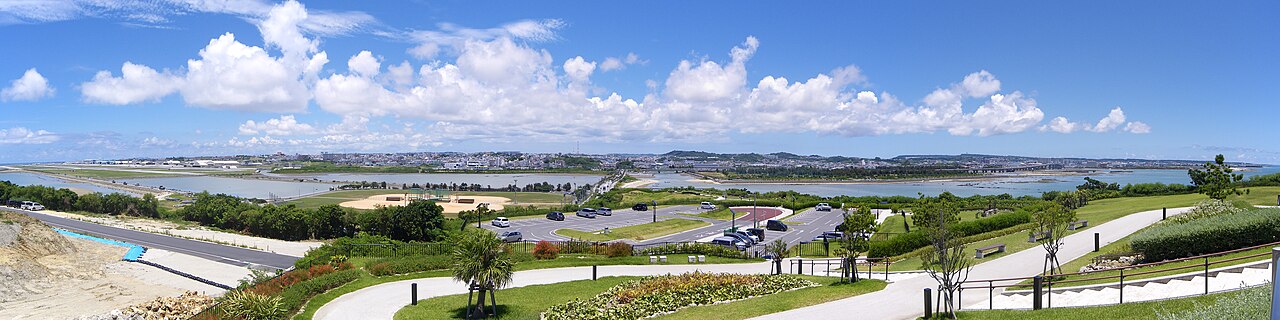
A small island with a circumference of about 1.5 km, just south of Naha Airport and connected to Tomigusuku City by road. According to the Tomigusuku City official page, there is a viewing plaza integrated with a parking lot at the top of the east side of the island, where you can watch aircraft taking off and landing up close. It is also said to offer a panoramic sunset in the evening. The parking on the island is public and free, for up to 693 cars.
Because this is public parking, the site notes that it takes no responsibility for accidents or theft, so do not leave valuables in the car. It is easy to stop by on your arrival or departure day, making it a good fit if you are looking for a spot near the airport.
| Address | 沖縄県豊見城市瀬長174番地6(瀬長島ウミカジテラス) |
|---|---|
| Hours | 10:00-21:00 (Umikaji Terrace; some shops differ) |
| Closed | Open year-round (varies by shop) |
| Parking | Public parking on the island, up to 693 cars, free |
| Access | About 15 min by car from Naha Airport |
Driving Tips for a Scenic Drive
Thinking About Parking and Road Width
Parking at viewpoints falls into two groups: small lots (Kyan Misaki has 15 spaces, and Kayauchi Banta does not have many) and large ones (Manzamo, Mt. Yaedake and Senaga Island). For small lots, you are more likely to find a space early in the morning or when the crowds ease.
The roads on islands and in villages are also the everyday roads of local residents. Where passing is difficult, take turns and give way to each other.
Weather, Typhoons and Time to Spare
Bridges, coastal roads and headlands can be closed during typhoons or strong winds. Check the weather before you set out, and keep your plans flexible. For UMUI Rent-a-Car’s typhoon policy, see our typhoon response page.
Refueling and Returning the Car
Gas stations become scarce once you leave the towns in the north and Yanbaru area, so it is safest to fill up early. UMUI Rent-a-Car’s Naha Airport branch is open 8:00-20:00 every day of the year, and after you return the car we take you to the airport by free shuttle. Work backward from your flight time and get back to the branch with time to spare.
Scenic Drive FAQ
How many spots can I visit in one day?
Within the same area, two or three spots in half a day is a comfortable pace. For example, Niraikanai Bridge and Chinen Misaki Park in the south, or Zanpa Misaki and Manzamo in Onna Village in the center. Combining nearby spots lets you enjoy the views without rushing. The north is far, so we recommend staying one night.
Can I go if I am not used to driving?
Senaga Island, Manzamo, Zanpa Misaki and Chinen Misaki Park are close to main roads and relatively easy to reach. For Mt. Yaedake, up a mountain road, and for Cape Hedo and Kayauchi Banta in the far north, allow plenty of time and take extra care when driving.
Is it still worth going on a rainy or cloudy day?
How the view looks depends on the weather, and distant islands can disappear in rain or cloud. On days when the weather looks bad, you can save the view-focused spots for another day and do indoor sightseeing first.
Whether you cross a bridge, stand on a cape or look out from a hilltop, the same sea shows a completely different face on Okinawa’s main island. Once you have a few places in mind, plan a trip at your own pace with UMUI Rent-a-Car. From our Naha Airport branch, we offer a free shuttle.
* Business hours, prices and other information in this article are as of October 2026. They may change, so please check each facility’s official website before you go. Travel times are estimates assuming no traffic.
Photo credits: Wikimedia Commons (CC BY 2.0 / CC BY-SA 3.0 / CC BY-SA 4.0). Photographers are credited in each photo caption.